Flood guide · Explainer · 13 min
What a Sea-Level Scenario Does — and Does Not — Show
A detailed guide to the boundaries of sea-level and elevation screening: what highlighted terrain means, what it cannot prove, and how to avoid confusing scenario maps with flood forecasts, hydraulic models or official warnings.
A sea-level scenario can be extremely useful when you want to understand relative terrain. It can help you see low-lying patterns, compare nearby locations and identify places that deserve a closer look.
But it becomes misleading when a simple elevation screen is treated as if it were a complete flood model.
The safest way to use Flood by Outborn is to understand both sides of the tool:
What the scenario can show you — and what it cannot prove.
That boundary is the focus of this guide.
Open the map: Flood by Outborn

The short version
A sea-level scenario can show:
- terrain at or below a chosen elevation threshold;
- relative low-lying patterns;
- areas that change as the threshold increases;
- locations worth investigating further;
- a useful starting point for scenario planning.
It does not prove:
- exact flood depth at a property;
- when flooding will happen;
- how fast water will move;
- how long flooding will last;
- whether drainage systems will cope;
- whether levees, pumps or barriers will hold;
- what tides, storm surge or waves will do;
- whether an official warning applies;
- whether evacuation is necessary.
That distinction should shape every interpretation.
What the map actually compares
Flood’s sea-level view compares terrain elevation against a user-selected threshold.
If terrain is at or below the threshold, it can be highlighted.
This is a useful screening operation because elevation is one part of flood exposure.
But elevation alone does not describe the full water system.
A real flood outcome depends on how water enters, moves through and leaves an area.
That involves hydrology, drainage, structures, weather, tides and local infrastructure.
What the scenario does show
1. Relative low-lying terrain
The clearest use is identifying land that sits lower than nearby areas.
This can help reveal:
- low road segments;
- depressions;
- lower entrances;
- broad low-lying neighborhoods;
- low industrial access points;
- coastal terrain differences.
2. Sensitivity to threshold changes
If you increase the scenario threshold gradually, you can see which areas become highlighted first.
That helps identify terrain that is more sensitive to the chosen level.
3. Geographic comparison
The same threshold can be used to compare:
- two neighborhoods;
- two factory gates;
- two coastal sites;
- two parking locations;
- a property and an alternative route.
4. Questions for further investigation
A good screening map helps you ask better questions.
For example:
- Why is this road lower than the surrounding blocks?
- Is this low area connected to a canal?
- Is there a wall or embankment here?
- Does the site have pumping?
- Is the basement entrance lower than the road?
- Is there a higher route nearby?
5. A starting point for preparedness
The map can lead to practical actions:
- identify backup parking;
- review access routes;
- inspect vulnerable entrances;
- protect equipment;
- ask building management about flood controls;
- review official water information.
What the scenario does not show
1. It does not calculate exact flood depth
A highlighted pixel does not automatically tell you how deep water would be there.
To calculate flood depth properly, you need a valid water surface and a model that represents the relevant hydrological or hydraulic processes.
2. It does not predict timing
The threshold is not a date or forecast.
A 1-metre or 2-metre scenario does not mean that level will occur tomorrow, next year or at all.
3. It does not simulate water movement
Water does not simply appear everywhere below the same elevation.
Actual movement depends on:
- channels;
- barriers;
- gradients;
- drainage;
- gates;
- pumps;
- river flow;
- coastal conditions.
4. It does not automatically include local flood defenses
A levee, wall, raised road or embankment can materially change water pathways.
A simple terrain screen cannot be assumed to represent every protection structure.
5. It does not fully simulate drainage
Urban flooding can be shaped by pipe capacity, pumps, blocked drains, canal levels and operational controls.
Those are separate from terrain elevation.
6. It does not model tides, waves or storm surge as a complete system
Coastal flooding is not simply “sea level + elevation.”
Tides, atmospheric pressure, wind, waves, surge, defenses and estuary dynamics can all matter.
7. It does not prove hydrological connectivity
A low basin may be highlighted even if water cannot easily reach it under the scenario being considered.
8. It does not give an official hazard classification
Map colors inside Flood are not government warning levels.
9. It does not replace evacuation guidance
If local authorities issue an evacuation order or emergency instruction, follow the official instruction.
Why two places at the same elevation can behave differently
Suppose Site A and Site B are both around 1.5 metres elevation.
That does not mean they have the same flood exposure.
Site A might have:
- a flood wall;
- good drainage;
- a pumping station;
- a raised access road.
Site B might have:
- an open connection to a canal;
- poor drainage;
- a lower access road;
- no flood defense.
Same elevation, different real-world outcome.
This is why elevation screening is best treated as context, not verdict.
Hydrological connectivity: the concept many people miss
One of the most important questions after seeing highlighted terrain is:
Can water actually reach this place?
A simple elevation threshold does not answer that by itself.
Hydrological connectivity can be influenced by:
- rivers;
- canals;
- culverts;
- drains;
- floodgates;
- embankments;
- roads;
- buildings;
- walls;
- pumps.
A highlighted depression that is isolated behind defenses may behave very differently from a low corridor directly connected to a river.
This is one reason a screening map should trigger investigation rather than certainty.
Drainage can matter more than elevation in cities
In dense urban areas, especially places like Bangkok, drainage systems can be decisive.
Flooding may occur because:
- rainfall intensity exceeds drainage capacity;
- pumps cannot keep up;
- drains are blocked;
- canals are already high;
- local roads form low points;
- construction changes runoff patterns.
This means:
A place does not need to sit below a sea-level threshold to experience urban flooding.
And the reverse is also true:
A low-lying area does not necessarily flood every time heavy rain occurs.
Why coastal interpretation needs extra care
Coastal screening is useful, but it is easy to overstate.
A sea-level threshold does not automatically include:
- astronomical tide;
- storm surge;
- wave setup;
- wave run-up;
- coastal erosion;
- seawalls;
- beach morphology;
- river backwater;
- estuary effects.
The scenario can help identify low terrain near the coast.
It cannot by itself determine a future inundation line.
For engineering, investment or regulatory decisions, use appropriate coastal hazard studies and official data.
Scenario, forecast and observation should not be mixed
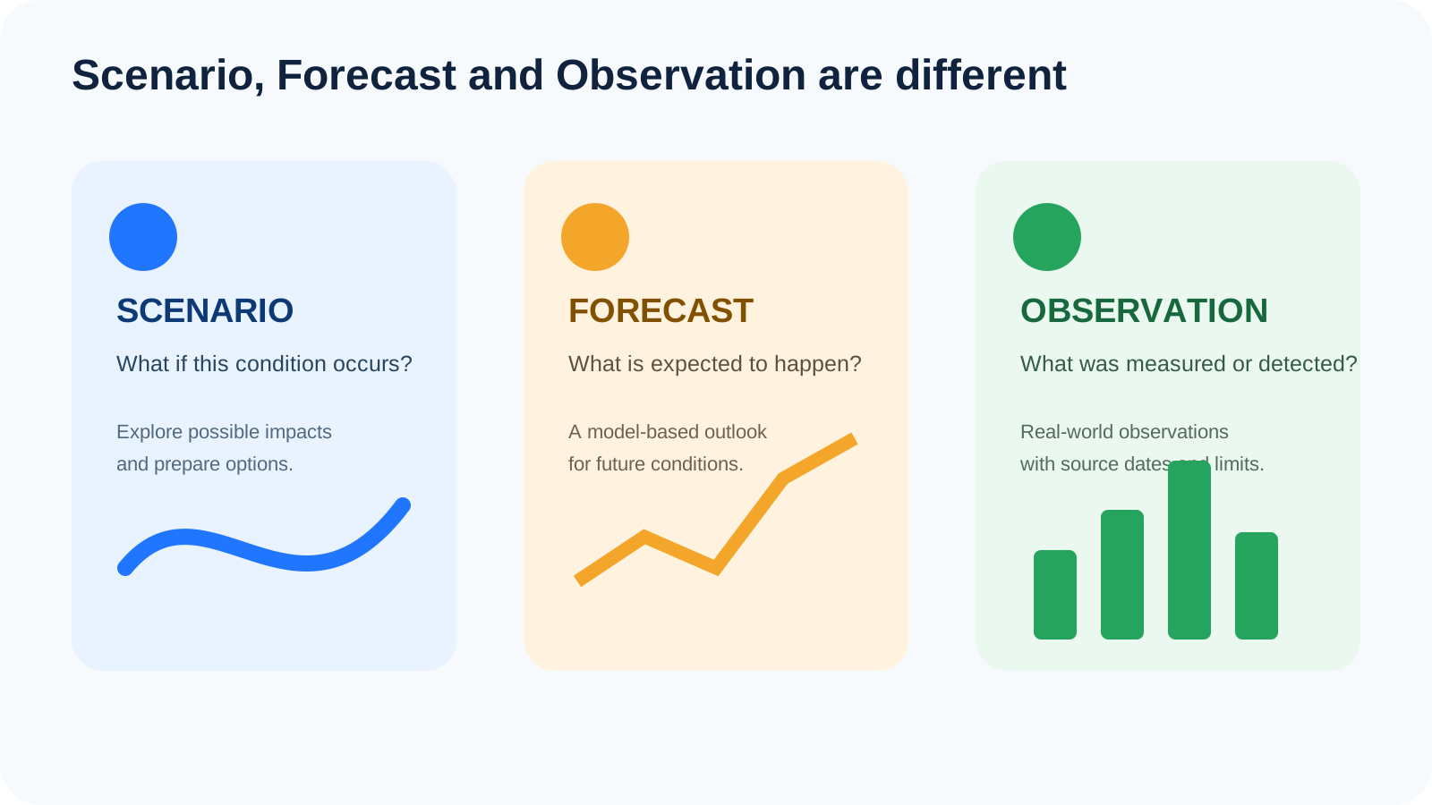
Scenario
A conditional exploration:
“If I use this threshold, what terrain is at or below it?”
Forecast
A future estimate:
“What does a model expect over a future period?”
Observation
A measurement:
“What has been detected or measured?”
The sea-level screen belongs primarily in the scenario category.
That matters because each category supports different decisions.
Use case: screening a home
A homeowner can use the scenario to ask:
- Is the house lower than the road?
- Is the road lower than the surrounding area?
- Is the garage entrance a low point?
- Is there a canal nearby?
- Where is the closest higher parking?
- Is there another exit route?
Then verify with:
- past flood history;
- local government;
- neighbors;
- building plans;
- insurance records;
- site inspection.
The map helps you decide what to investigate next.
Use case: screening a condominium
For a condo, the building footprint may be less important than:
- basement ramp;
- parking levels;
- electrical rooms;
- generator location;
- road access;
- nearby intersections;
- alternative entrances.
A sea-level screen can help you identify where to ask detailed questions from building management.
Use case: screening a business
Businesses should think in terms of continuity.
The critical question is often:
What is the lowest dependency that can stop operations?
That dependency may be:
- a loading bay;
- truck access;
- staff transport route;
- generator room;
- warehouse entrance;
- supplier route.
A business can remain structurally dry while operations still stop.
Use case: screening a factory or warehouse
For an industrial site, map:
- primary gate;
- secondary gate;
- truck route;
- loading area;
- power systems;
- critical equipment;
- raw-material storage;
- finished-goods storage.
Then ask:
- Which point becomes sensitive first as the threshold increases?
- Is there a higher gate?
- Can trucks reroute?
- Can equipment be raised or relocated?
- Is the same hazard affecting suppliers?
This turns a simple scenario map into a useful BCP discussion.
Use case: property due diligence
A sea-level screen is useful when comparing properties, but only as one layer of due diligence.
It can help identify:
- low road access;
- depressions;
- nearby waterways;
- terrain differences;
- areas that deserve professional review.
Do not use it alone to conclude:
- “this property is safe”;
- “this property will flood”;
- “insurance should cost more”;
- “this property should be avoided.”
Those conclusions require broader evidence.
Common misuse patterns
Misuse 1: “Highlighted means flooded”
Incorrect. Highlighted means terrain is at or below the selected threshold.
Misuse 2: “Threshold equals water depth”
Incorrect. Flood depth requires a valid water surface and ground elevation at the same location.
Misuse 3: “Higher terrain is safe”
Not necessarily. Access, drainage and infrastructure can still fail.
Misuse 4: “The slider predicts the future”
It does not.
Misuse 5: “One screenshot proves risk”
A screenshot without the threshold, layer type, source date and local context can be misleading.
Misuse 6: “The map can override official guidance”
It cannot.
What to check before sharing a screenshot
Before sharing a Flood scenario, include:
- the scenario threshold;
- the map layer;
- the location;
- the relevant source date where applicable;
- a note that the image is a screening scenario;
- a link to official information if the situation is current.
Good caption:
“Scenario screening at the selected elevation threshold. This is not a forecast or official warning.”
Avoid:
“This is where the flood will go.”
Decision boundaries: when the map is enough, and when it is not
The map may be enough for:
- education;
- comparing terrain;
- early screening;
- scenario workshops;
- identifying questions;
- household preparedness discussions.
The map is not enough for:
- evacuation decisions;
- engineering design;
- insurance underwriting;
- property valuation;
- regulatory compliance;
- emergency command;
- exact flood-depth calculation.
This boundary protects users from overconfidence.
A practical “screen → verify → prepare” model
Use Flood in three stages.
Screen
Use the scenario to identify low terrain and sensitive locations.
Verify
Use official sources, local history, site inspection and expert input where needed.
Prepare
Choose actions:
- backup route;
- higher parking;
- equipment relocation;
- shutdown plan;
- communication plan.
This is a better workflow than trying to force the map to answer questions it was never designed to answer.
Frequently asked questions
Does the sea-level scenario show future sea-level rise?
Not by itself. It is an elevation screening threshold unless a specific dataset or scenario is explicitly defined otherwise.
Does highlighted terrain mean the area is underwater?
No.
Does the map include pumps and drainage systems?
A simple terrain-screening layer should not be assumed to model all drainage operations.
Does it include flood walls?
Do not assume every local defense is represented.
Can the map calculate storm surge?
The sea-level screening layer should not be treated as a full storm-surge model.
Can I use it for emergency evacuation?
Use official emergency guidance for evacuation decisions.
Can I use it for buying property?
Use it as an early screening tool, then verify with local and professional sources.
Why does the map highlight an inland depression?
Because the terrain may be below the chosen threshold even if it is not hydrologically connected to the sea.
Why might a non-highlighted location still flood?
Rainfall, drainage failure, river overflow or infrastructure conditions can create flooding outside a simple sea-level scenario.
What is the best way to use the tool?
Use it to identify questions and preparedness actions, then verify real-world conditions with authoritative sources.
Final takeaway
The value of a sea-level scenario is not that it predicts the future.
Its value is that it helps you see the terrain differently.
It can reveal:
- where land is relatively low;
- which access points deserve attention;
- where to compare alternatives;
- what to investigate next.
But it cannot prove the full flood outcome.
The best use of Flood is therefore:
Screen broadly. Interpret carefully. Verify with authoritative information. Prepare practically.
Was this article useful?
Leave a comment
Comments appear publicly after submission and are reviewed afterward.
Get Outborn updates
New articles and practical ideas in your inbox.