Flood guide · Guide · 17 min
How to Use a Flood Map to Screen Low-Lying Areas in Thailand
A practical guide to using Flood by Outborn for low-lying area screening: compare terrain, test scenarios, interpret observed data correctly, plan routes and preparedness, and combine the map with official Thai weather and water information.
Flood risk is rarely a simple yes-or-no question. A neighborhood may sit on relatively low terrain but benefit from drainage, embankments or pumping. Another location may appear higher yet still be affected by local drainage constraints, river overflow, access-road flooding or water moving in from upstream.
That is why the most useful question is often not:
“Will this exact property flood?”
A better first question is:
“If water reaches a certain level, which parts of this area deserve a closer look, and what should I prepare before conditions become urgent?”
That is the role of Flood by Outborn. It is a map-based screening and scenario tool designed to help people explore terrain, low-lying areas and flood-related context before making practical plans.
Flood is not a flood forecast, not an official warning service, and not a property-level engineering assessment. Some layers may show observed or contextual data, but those layers can have source-date, coverage and update limitations. For real-world warnings and emergency decisions, use official Thai government information alongside the map.
Open the map: Flood by Outborn
Why low-lying area screening matters in Thailand
Thailand’s flood exposure is shaped by several overlapping conditions: monsoon rainfall, river systems, low-gradient floodplains, dense urban drainage networks, coastal conditions and local topography.
The current weather situation is a useful example. On 28 September 2026, the Thai Meteorological Department warned of heavy to isolated very heavy rain in parts of the western and lower North, western Central Thailand and the East, with risks including flash floods, overflows and landslides, especially along waterways, foothills and lowlands. The warning does not mean every low-lying place will flood, but it highlights why lowlands deserve attention when rainfall accumulates.
Source: Thai Meteorological Department — Heavy to Very Heavy Rain in Thailand No.18
Water conditions also have to be read at the basin level. The Royal Irrigation Department reported on 27 September 2026 that discharge through Chao Phraya Dam was 1,950 m³/s, compared with 1,850 m³/s the previous day. At Bang Sai, flow was 1,895 m³/s, compared with 1,748 m³/s the previous day. Those numbers are not a prediction that a particular home or road will flood; they are examples of why river context can matter even when rainfall at one location has already eased.
Source: Royal Irrigation Department — Runoff Report, 27 September 2026
For households and businesses, the practical lesson is simple:
Do not rely on one signal. Combine terrain screening, official weather warnings, river information, local announcements and your own knowledge of the site.
What Flood by Outborn is designed to help you do
Flood is most useful as a screening and planning tool. It can help you:
- compare the relative elevation of nearby areas;
- test sea-level or water-level scenarios;
- inspect individual points on the map;
- review source dates and contextual information where available;
- compare map views;
- save important places;
- share an exact map view with another person;
- identify locations that deserve further investigation;
- turn a map observation into a preparedness action.
The key word is screening.
Screening does not replace a detailed hydrological model, a site survey, a drainage study, a government warning or an engineering assessment. It helps narrow your attention to the places and questions that matter most.
Scenario, forecast and observation are not the same thing
One of the easiest ways to misuse any flood map is to treat every layer as if it represents the same type of information.
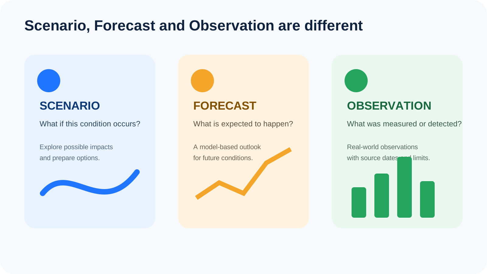
Scenario: “What if this condition occurred?”
A scenario lets you explore the consequences of a selected condition.
For example, if you choose a water-level threshold and see which terrain is highlighted, the map is helping you ask:
- Which streets appear lower than nearby roads?
- Which access points could become vulnerable earlier?
- Which facilities are surrounded by lower terrain?
- Which nearby higher areas might work as backup locations?
A scenario does not say that the selected condition will occur.
Forecast: “What is expected to happen?”
A forecast estimates future conditions using observations and models.
Weather forecasts and official hydrological forecasts belong in this category. Forecasts have uncertainty and should be read with their issue time, forecast period and official guidance.
Flood by Outborn should not be described as a flood-prediction engine.
Observation: “What has been measured or detected?”
Observed data comes from the real world: gauges, satellites, radar, rain stations or other sensors.
An observed-flood layer can be valuable, but “observed” does not automatically mean “live.” Satellite imagery, for example, depends on acquisition timing, revisit cycles, cloud conditions and processing. Always check the source date.
Step 1: Start with a place you actually need to make a decision about
A common mistake is opening a national map and looking at a huge area without a decision in mind.
Instead, begin with a meaningful location:
- your home;
- a parent’s home;
- your condominium;
- your office;
- a shop;
- a warehouse;
- a factory;
- a school;
- a hospital route;
- a backup parking location;
- a daily commuting corridor.
Then define the decision.
Examples:
- “Where would I move the car?”
- “Which entrance should our factory keep open?”
- “Is the road outside the building lower than the building itself?”
- “If the main road is disrupted, do we have another route?”
- “Which family member would need help first?”
A map becomes much more useful when it is attached to a real decision.
Step 2: Look at relative terrain, not only one elevation number
Elevation values are useful, but one point alone rarely tells the full story.
Imagine a house with a ground elevation that appears reasonable. That information becomes more meaningful only when you compare it with:
- the street in front of the property;
- the entrance to the neighborhood;
- nearby canals or rivers;
- the lowest road segment on the normal route;
- nearby higher ground;
- adjacent developments.
What often matters in screening is the difference between locations.
If your home sits slightly higher than the road but the only exit passes through a lower underpass, your access route may become the more important risk to plan around.
Practical technique
Inspect at least five points:
- the building or property;
- the primary access road;
- the lowest-looking point nearby;
- the nearest waterway or drainage corridor;
- a possible higher backup location.
The goal is not to declare a precise flood depth. The goal is to understand the terrain pattern.
Step 3: Test more than one scenario
Do not stop after selecting a single threshold.
Try several levels and watch what changes first.
Ask:
- Which road is highlighted before the others?
- Which entrances become isolated?
- Which facilities remain outside the highlighted area longer?
- At what point does the pattern change from a small pocket to a wider connected area?
- Are there apparent low spots that deserve local verification?
This is basic scenario planning: instead of trying to guess the one “correct” future, you look at several plausible conditions and prepare flexible responses.
Use scenarios as triggers for questions, not claims
Good:
“At a higher screening threshold, this access road becomes part of the highlighted low terrain, so we should identify an alternative route.”
Poor:
“This road will definitely be flooded tomorrow.”
That distinction is essential.
Step 4: Check whether the highlighted area is actually connected to water
A simple elevation screen can visually highlight terrain below a selected level, but real flooding depends on more than height.
Questions to ask:
- Is the low area connected to a river, canal, coast or drainage path?
- Are there levees, walls, embankments or flood defenses?
- Does the neighborhood have pumps or controlled drainage?
- Are there roads or structures that block or redirect flow?
- Is the area a closed depression that collects rainfall?
- Does water usually arrive from rainfall, river overflow, tidal influence or another source?
This is why Flood’s sea-level screening should be treated as broad screening, not a detailed flood simulation. Flood’s own method note states that defenses, tides, waves, drainage and hydrologic connectivity are not all modeled in a simple screening view.
A low pixel on a map is not the same as a confirmed flooded property.
Step 5: Read the source date before interpreting an observed layer
If you use observed-flood or contextual layers, always ask:
“What date does this layer represent?”
Satellite-derived products are especially important to read carefully.
A satellite observation can be affected by:
- revisit timing;
- cloud cover;
- sensor characteristics;
- processing time;
- land cover;
- shadows or complex urban surfaces;
- the minimum size of water features that can be detected reliably.
The phrase “latest available” should never be assumed to mean “this minute.”
If a safety decision depends on current conditions, check official current sources and local reports.
Step 6: Use rainfall and river context as supporting evidence
Flooding can happen for different reasons, and the correct context depends on the area.
For urban rainfall flooding
Look at:
- recent and forecast rainfall;
- duration and intensity;
- known drainage bottlenecks;
- underpasses and low roads;
- local authority updates.
For riverine flooding
Look at:
- upstream river levels and flow;
- reservoir and barrage information;
- downstream conditions;
- government basin reports;
- local flood defenses.
For coastal or estuary areas
Consider:
- terrain elevation;
- tide and sea conditions;
- coastal defenses;
- river discharge;
- wave conditions;
- local drainage.
The point is not to combine data until you get a number that “looks scientific.” The point is to use each source for the question it is actually able to answer.
Step 7: Compare nearby places at the same threshold
One of the most useful Flood workflows is comparison.
Keep the same scenario level and move between nearby areas.
This can help reveal:
- one neighborhood that is systematically lower than another;
- a road corridor that sits below surrounding blocks;
- a higher ridge or raised roadway;
- a low industrial access point;
- relative differences between coastal areas.
Comparisons are often more useful than an isolated map screenshot because they provide context.
Example: two neighborhoods
If Neighborhood A and Neighborhood B are only a few kilometers apart, compare them at the exact same threshold.
Do not ask only:
“Which one is blue?”
Ask:
“How much of each neighborhood changes, where are the access routes, and what physical features could explain the difference?”
Step 8: Save important places and share the exact view
Flood can save locations and share a map view.
That turns an individual observation into a coordination tool.
Useful saved places might include:
- Home
- Parents
- School
- Office
- Warehouse
- Factory gate
- Backup parking
- Hospital
- Meeting point
When discussing a location with family or colleagues, share the exact view rather than sending a vague message like “this area looks risky.”
A shared view reduces misunderstanding about:
- map position;
- zoom;
- basemap;
- scenario setting;
- point being discussed.
Using Flood for Bangkok and the metropolitan area
Bangkok flood planning should rarely focus only on the building itself.
Urban disruption can come from roads, drainage, canals and access constraints.
For a condominium, inspect:
- the building entrance;
- basement parking access;
- the road immediately outside;
- nearby low intersections;
- alternative vehicle exits;
- nearby higher parking;
- critical electrical rooms if you know their location.
For a house in a soi, inspect:
- the mouth of the soi;
- the lowest part of the route to the main road;
- nearby canals;
- bridges or underpasses;
- an alternative route out.
For commuting, screen the whole route, not just the origin and destination.
A home and office can both remain accessible individually while the connecting road becomes the actual problem.
Using Flood in the Chao Phraya basin
For communities connected to the Chao Phraya system, terrain screening should be paired with official river information.
A sensible workflow is:
- save the home or facility in Flood;
- inspect relative terrain and access roads;
- test scenarios to identify sensitive locations;
- check the Royal Irrigation Department for river and discharge information;
- check provincial and local announcements;
- define actions before conditions become urgent.
The 27 September 2026 RID report is a useful example of why river context matters: Chao Phraya Dam discharge and Bang Sai flow were both higher than the previous day. That does not tell you the flood depth at a house. It tells you that basin conditions deserve attention and that local screening should be paired with official hydrological information.
Source: Royal Irrigation Department
Using Flood for coastal and low-elevation areas
The sea-level scenario can be useful for broad coastal screening, but it should be interpreted conservatively.
A sea-level threshold does not fully model:
- tides;
- waves;
- storm surge;
- coastal defenses;
- river backwater effects;
- pumps;
- drainage capacity;
- every channel connecting terrain to the sea.
Use it to ask:
- Where is the lowest terrain?
- Which access routes are closest to that terrain?
- Which facilities need more detailed investigation?
- Where would a site-specific study be worthwhile?
Do not use it to claim an exact future shoreline or property-level flood depth.
For homeowners and renters: questions worth asking after screening
If a location looks low relative to its surroundings, investigate further before making a high-value decision.
Ask:
- Has the street flooded before?
- How high did water reach?
- Was the source rainfall, river overflow, canal water or another cause?
- Is the house floor higher than the road?
- How does the entrance compare with surrounding land?
- Where is the electrical panel?
- Is parking at ground level or below ground?
- What drainage infrastructure exists?
- What do neighbors report?
- Are there local flood-protection works?
- What does insurance cover?
Flood can help you identify questions. It should not be the only evidence used to buy, rent, insure or value property.
For shops and small businesses: screen continuity, not only water
For a small business, a few centimeters of water on an access road can matter even if the shop itself stays dry.
Screen:
- customer access;
- staff commuting routes;
- delivery access;
- stock storage;
- electrical equipment;
- POS and network equipment;
- alternative operating locations;
- parking;
- nearby suppliers.
Then define practical triggers.
Watch
Review official weather and local updates.
Prepare
Raise stock, charge devices, contact staff and move movable equipment.
Restrict operations
Reduce travel or close access when official or site conditions become unsafe.
The aim is to reduce rushed decisions.
For factories and warehouses: use the map as a BCP conversation starter
Industrial sites have dependencies beyond the building footprint.
Mark:
- main and secondary gates;
- truck access;
- loading bays;
- raw-material storage;
- finished-goods storage;
- electrical rooms;
- generators;
- server or network rooms;
- staff transport routes;
- nearby worker accommodation;
- critical suppliers.
Then ask:
- If the main gate is inaccessible for 24 hours, what stops?
- Which stock must move first?
- Can trucks use another entrance?
- How long can critical systems run on backup power?
- Which staff can work remotely?
- Which suppliers are exposed to the same event?
- Who has authority to stop operations?
- How will employees receive instructions?
A Flood screening session can support a BCP workshop, but critical infrastructure should receive a professional site-specific assessment where appropriate.
Common mistakes when reading a low-lying area map
Mistake 1: Treating elevation as flood probability
Low elevation can be relevant, but it is not a complete probability model.
Mistake 2: Reading a scenario as a forecast
A scenario is conditional: if this level, then this screening pattern.
Mistake 3: Ignoring defenses and drainage
Local infrastructure can materially change real outcomes.
Mistake 4: Ignoring access roads
The property may remain dry while the route becomes unusable.
Mistake 5: Forgetting the source date
Observed data without a source date can be badly misinterpreted.
Mistake 6: Sharing screenshots without context
Always include whether the image is a scenario, observation or forecast and include the relevant date.
Mistake 7: Using one map for a high-stakes decision
Property purchases, evacuation decisions and engineering designs need more than a screening map.
From screening to preparedness: what to do next
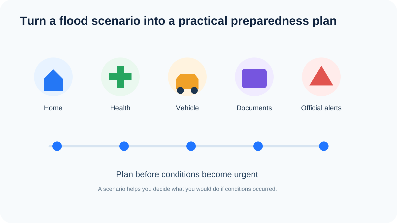
A useful map session should end with actions.
Household
- identify a higher backup parking location;
- move irreplaceable documents away from floor level;
- keep medicines accessible;
- charge power banks;
- know how to isolate electricity safely;
- agree on a family meeting point;
- identify an alternative route;
- plan for children, older adults and pets.
Business
- prioritize movable stock;
- document shutdown procedures;
- identify critical equipment;
- create staff communication channels;
- review supplier dependencies;
- define who can authorize closure or relocation;
- document recovery priorities.
Community
- share the same map view;
- identify vulnerable residents;
- confirm official communication channels;
- avoid spreading screenshots without dates or explanation.
A 15-minute Flood screening workflow
If you want something simple, use this:
Minutes 1–3
Search for your location and inspect the immediate area.
Minutes 4–6
Check relative elevation across the property, road and access points.
Minutes 7–9
Test multiple scenario levels and note which locations change first.
Minutes 10–11
Review source dates and contextual layers available for the area.
Minute 12
Check the latest Thai Meteorological Department information.
Minute 13
If a river basin is relevant, check Royal Irrigation Department information.
Minute 14
Save the location and share the exact view with the people who need it.
Minute 15
Write three actions:
- Where would vehicles go?
- What needs to be moved or protected?
- What route or meeting point would be used?
The value is not the map alone. The value is the decision it helps you prepare.
Which official sources should you use with Flood?
Thai Meteorological Department (TMD)
Use for weather forecasts, rainfall warnings, storms and severe-weather advisories.
www.tmd.go.th
Royal Irrigation Department (RID)
Use for river, reservoir, barrage and water-management information.
www.rid.go.th
Department of Disaster Prevention and Mitigation (DDPM)
Use for disaster information, safety guidance and official response information.
www.disaster.go.th
Office of the National Water Resources (ONWR)
Use for national water-management context and water-related coordination.
www.onwr.go.th
ThaiWater
Use as a national water-information resource for broader water and weather context.
www.thaiwater.net
Flood by Outborn
Use for scenario screening, relative terrain exploration and map-based planning.
flood.outborn.co
Frequently asked questions
Is Flood by Outborn real-time?
It should not be described as a fully real-time flood-warning system. Some contextual or observed layers may be based on the latest available source data, which can lag depending on the provider, satellite revisit timing, clouds, processing and coverage.
Can Flood tell me whether my house will flood tomorrow?
No. Flood is not a property-level flood forecast.
What does the water-level or sea-level scenario mean?
It is a screening condition that helps show how low terrain relates to a selected threshold. It does not mean that the chosen level is forecast to occur.
Why might a low area not flood?
Possible reasons include flood defenses, pumps, drainage, barriers, lack of hydrologic connection to a water source, or simply that the triggering conditions do not occur.
Why might a higher area still have problems?
Local drainage, blocked access, river overflow, intense rainfall, infrastructure failure or nearby lower roads can still disrupt the area.
Can I use Flood before buying a home?
Yes, as an initial screening tool. Use it to identify questions for further investigation. Do not use it as the sole basis for a property or insurance decision.
Can businesses use it?
Yes. It can support preparedness and business-continuity discussions about access, staff, stock, utilities and logistics.
If an official evacuation order is issued, should I check Flood first?
No. Follow official instructions immediately. A screening map should never delay an emergency action.
Why do satellite-observed layers have gaps?
Satellites have revisit schedules and sensor limitations. Clouds, land cover and processing can also affect what is detected.
What should I include when sharing a Flood screenshot?
Include the scenario setting or layer name, the source date where relevant, and a note explaining that the view is screening/context rather than an official forecast.
The most important takeaway
A good flood map does not need to pretend it can answer every question.
Its value is in helping you ask better ones:
- Where is the lowest part of my route?
- Which access point deserves attention?
- What changes first when I test a more severe scenario?
- What information do I still need from official sources?
- What can I prepare today?
Flood by Outborn is designed to support that kind of thinking.
Screen first. Verify with official sources. Prepare before the decision becomes urgent.
Sources and further reading
- Thai Meteorological Department — Heavy to Very Heavy Rain in Thailand No.18, 28 September 2026
- Royal Irrigation Department — Runoff Report, 27 September 2026
- Thai Meteorological Department
- Royal Irrigation Department
- Department of Disaster Prevention and Mitigation
- Office of the National Water Resources
- ThaiWater
Updated: 28 September 2026. Flood by Outborn is a screening and scenario-planning tool. It is not an official warning system, not a property-level engineering assessment and not a guarantee of future flood conditions.
Was this article useful?
Leave a comment
Comments appear publicly after submission and are reviewed afterward.
Get Outborn updates
New articles and practical ideas in your inbox.